
Weather Station Network
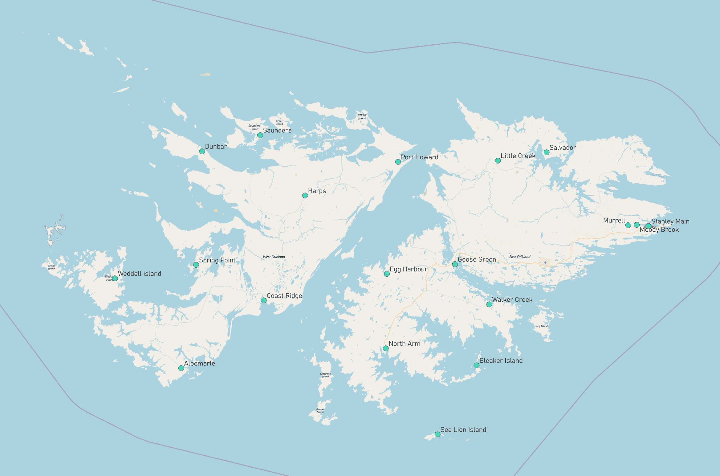 Map of the locations of weather stations across the Falkland Islnds.
A network of weather stations have been set up across the Falkland Islands in various locations. As well as providing real time weather information for the local area, the data collected from the stations will be stored and analysed periodically. This will help us to identify any emerging trends in weather patterns, the frequency of extremes, and enable us to gain a better understanding of the relationship between the land and the environment at the locations and across the islands. Long term, these datasets will feed into looking at climate trends in the Falkland Islands, and help to increase the reliability of climate projections.
What are the weather stations, and what do they do?
The weather station is a Davis Vantage pro 2. It records the following variables: temperature, rainfall, rain rate, wind direction, wind speed, air pressure, solar radiation, soil moisture, soil temperature. While most weather data is currently collected from the stations on a monthly basis, in time these stations will provide live data in real time.
What do the stations look like?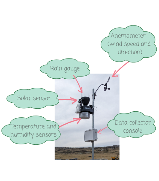
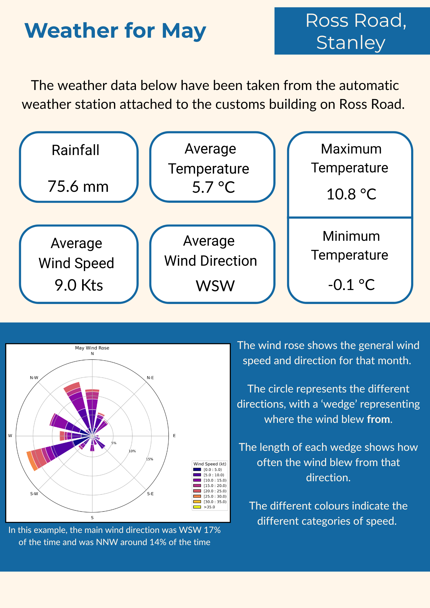
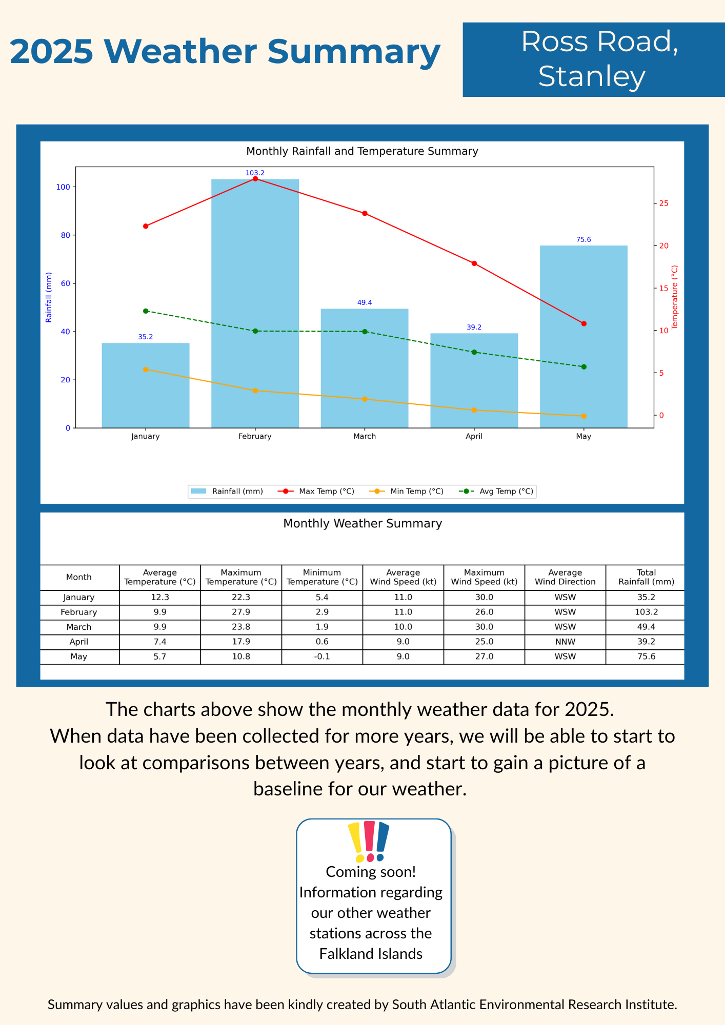
Ross Road, Stanley Summaries
The pdf documents below contain the summarised weather data collected from the Customs and Immigration building on Ross Road, Stanley, with summary values and graphics kindly created by the South Atlantic Environmental Research Institute.
May 2025
Jan- May 2025 Summary
For more information, please contact the Environment Department on:
Phone: + 500 28449
Email: